 |
|||||||||||||||||
L.A. River |
|||||||||||||||||
While many of us who grew up in the San Fernando Valley called the L.A. River “the wash,” it is in fact a true river. From its headwaters to the Pacific Ocean, the elevation change in the L.A. River is greater than the entire Mississippi River! No wonder the flow rate can be so tremendous during strong storms. |
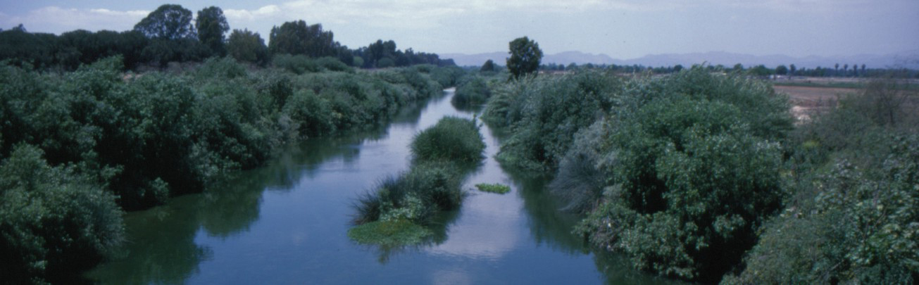 above, the L.A. River looking north from the Burbank Bridge in the late 1970’s before giant reed took over. |
|||
Native Americans depended on the river for centuries. One of their major villages, Yangna, was located in what is now downtown Los Angeles. The first European to see the river was the Spanish explorer, Don Gaspar de Portola, as he commanded a land expedition from San Diego to Monterey in 1769. Father Juan Crespi, principal diarist for the expedition, described the river as “well-grown with cottonwoods and alders passing through a spacious valley.” |
||
Historically, the Los Angeles River had a natural riparian edge much wider (up to several miles in some places) than what exists today. When flooding occurred, water would spread across the coastal plain, frequently redefining the course of the river and alternating its ocean outflow between Santa Monica and San Pedro Bays. As the flood waters spread over the land, lakes, ponds, marshes and sloughs formed, interspersed within a forest cover. Plant communities that once dominated the area adapted to flooding. Valleys and meadows supported an abundance of plants among the forest cover of cottonwood and alder trees. Also these communities supported large populations of native freshwater fish and birds, such as the Least Bell’s Vireo and Willow flycatchers, both currently listed as endangered species. |
||
Flooding became a problem as development came to the area. Extensive flooding occurred in 1825 and then in 1914. In 1934 the La Crescenta flood disaster caused the Flood Control District to seek assistance from Congress and the U.S. Army Corps of Engineers. Between 1938 and 1970, the Corps designed and built a regional flood control system which encompassed the River and its tributaries. |
||
In the sections of the river that have a high ground water table or that serve as flood control basins, the channel bottom was lined with boulders and cobble. The Sepulveda Basin is one of three areas along the L.A. River with a soft bottom (the other two are near Griffith Park and the Willow Avenue estuary area in Long Beach). |
||
While there is very little natural flow of water in the River throughout most of the year, reclaimed waste water now flows into the Los Angeles River in the Sepulveda Dam Basin from the Donald Tillman Water Reclamation facility. This water is of a very high quality, though not potable. This source currently provides 80% of the water in the river during the dry seasons. |
||
During the 1980’s the exotic giant reed began to invade the riparian corridors and the South Reserve. Eventually the giant reed was choking out the native vegetation, threatening a mono-culture of not very valuable vegetation that does not support the native fauna. After years of begging for some action, the Corps of Engineers embarked on a huge project to remove the giant reed from along the L.A. River. Coupled with other projects to eliminate giant reed from the South Reserve, today there are few infestations (primarily along Encino Creek), but constant vigilance will be required until all the giant reed in the watersheds above the Basin is eliminated. Being a grass, even a small shoot can turn into a plant, and when the Basin floods, all kinds of debris, plant material and seeds flow into and get deposited in the Basin. |
||
 |
||
The portion of the L.A. River south of Burbank Blvd. (and adjacent to the South Reserve) is a very disturbed area and is typically stripped bare of vegetation after major storms. The sequence shown in the image below shows how the vegetation built up between 2002 and then was washed away by the storms of 2005. |
||
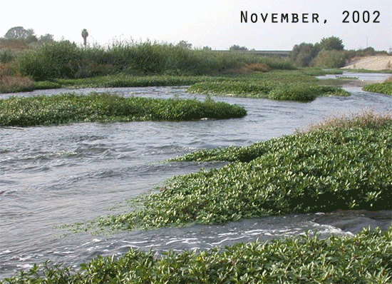 LA River Nov 2002 – Feb 2006 |
||
This same area, at the base of the Dam, is where sediments are deposited in shoals during heavy rainstorms and flooding. The Corps must regularly remove the built up sediments in this section of the river. |
||
The reach of the Los Angeles River between Balboa Blvd. and the MTA Orange Line trestle (where the busway crosses the river) was severely degraded due to the invasion of many large non-native palm, pine, and eucalyptus trees. It was felt that persons riding the busway would look out onto the river and see not native habitat but a mish-mash of native and non-native plants. A project implemented by The River Project led to the killing and subsequent removal of most of the non-native vegetation, allowing room for the natives to reclaim the riverbed. |
||
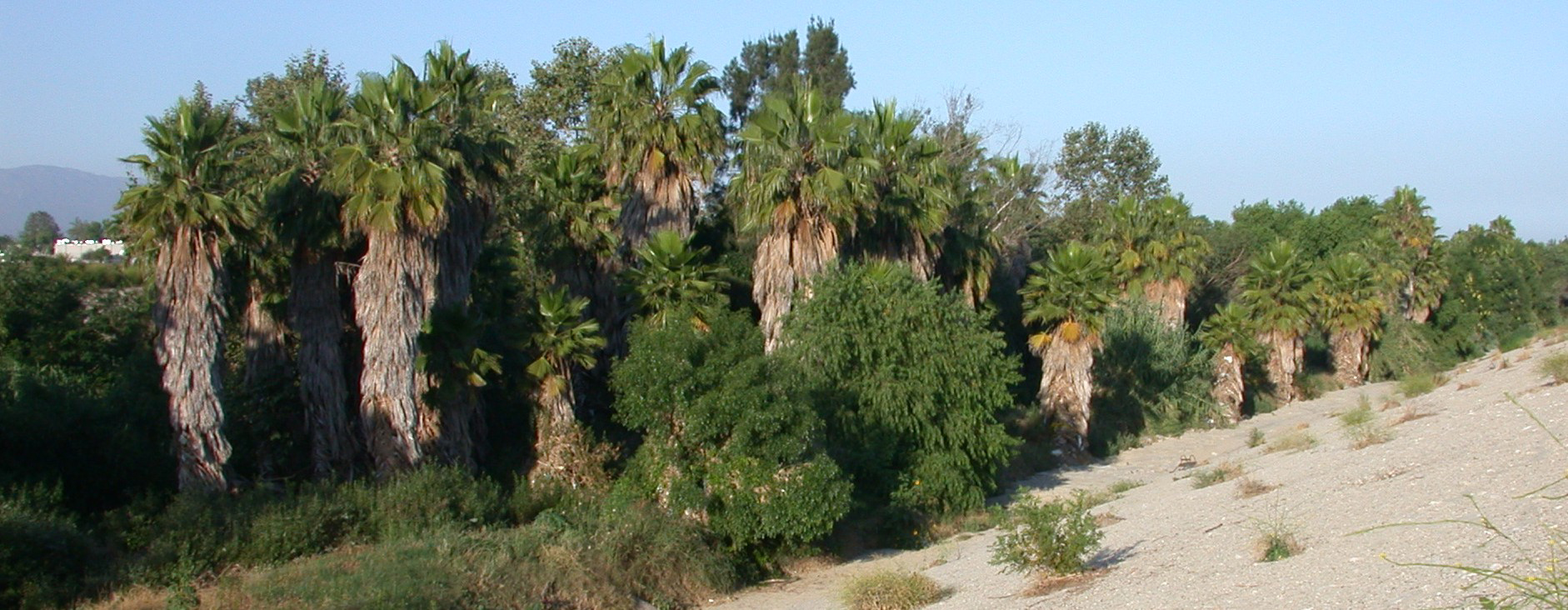 above, stretch of L.A. River just west of Orange Line overpass before treatment. |
||
 above, same area after removal of non-native palm trees (June 2008). |
||