 |
|||||||||||||
|
|||||||||||||
 |
|||||||||||||
|
Click
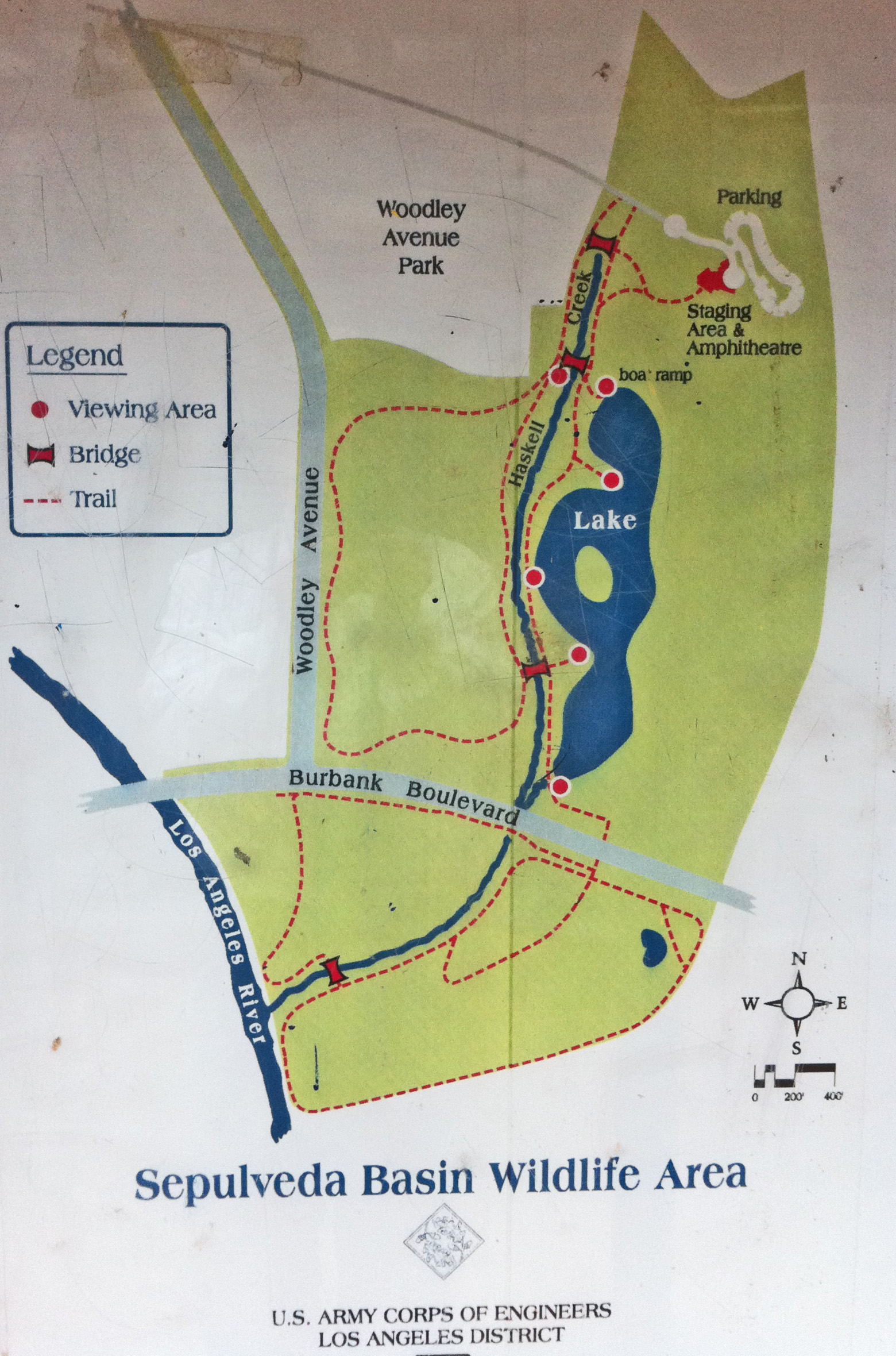
HERE for a Regional Trail Map of
the Basin (13.26MB pdf file) – Click
HERE for a local trail map of
the Wildlife Reserve
SBWASC has created a Facebook Group- Friends of the Sepulveda Basin Wildlife Reserve for sharing events and important updates and for people who love the reserve to connect and share photos and experiences. Here is the link to the group: https://www.facebook.com/groups/1750344635396210/ . The group will be moderated/managed by the Sepulveda Basin Wildlife Areas Steering Committee. Or, if Facebook isn't your thing, you can follow the journey on Instagram: https://www.instagram.com/sepulvedabasinwildlifereserve/  |
|||||||||||||







|
Join us for the Dawn Patrol or 4th Saturday Weeders at the Sepulveda Basin Wildlife Reserve!
Dawn Patrol: Every Thursday from Dawn for 3 hours 10/24 11/28
If you can’t make it at 7:00am, we should be just off a path near
the pond. Meeting Location: Sepulveda Basin Wildlife Reserve Dirt parking lot beneath the Big Pine (restrooms located nearby).
How to Sign Up? Click Here
We hope you'll be able to join us and please forward this website to anyone you think might enjoy the opportunity to get outside, meet a great group of people, help the environment, and/or learn about flora and fauna (all while ripping up some invasive plants, which for simplification we call ’weeds’).
Interested in being on the mailing list or volunteering on a different Saturday/own your own (weeding or picking up garbage)?
What to bring: Gloves and tools if you have them- we do have some extras. We also recommend you bring water, snacks and sunscreen, and wear a hat, long sleeves and pants for protection.
Our goal: The California Native Plant Society (CNPS) has an ongoing invasive plant removal effort throughout California. Our goal, as the 4th Saturday Weeders (you don’t have to be a member of CNPS), is to improve the habitat of the Sepulveda Basin Wildlife Reserve by removing invasive plants. We find that if ‘weeds’ are removed consistently for three years Native Plants are able to establish themselves (and the ‘weeds’ are much more controllable). We have a lot of expertise on the plants and have been able to make an important contribution to the Wildlife Reserve over the past 12 years!
Click
HERE to join
the Sepulveda Basin Weeding Facebook group.
Click
HERE to donate to the California Native Plant Society
Or use this QR code:
Sunday, November 1,
8am - 11am
Sunday, November 8, 9:00am—11:00am We welcome beginning birdwatchers, families, and groups by arrangement. This is a great opportunity to learn how to identify birds, their behaviors, and needs. You will also learn about the outstanding and currently challenged wildlife reserve. Each walk will vary with the interests of the participants. Binoculars are available to borrow. Please do not bring any pets. Wear sturdy shoes, layered clothing, and hat with a brim. Water and sunscreen suggested. Directions: Driving on Woodley Ave. north from Burbank or south from Victory Blvd., go ½ mile and turn east at the sign for the Japanese Garden. Continue straight (don’t turn into the garden) and drive past the cricket fields and around the tree in the middle of the road, continuing to the parking lot at the end of the road. Meet at the small amphitheater which is on the on the south side of the rock-faced buildings. GPS coordinates of parking lot: 34.179942,-118.472595. For more information, call Natalie Beckman-Smith at (818) 926–7825 or San Fernando Valley Audubon at (747) 237-3720. Heavy rain cancels. Please let us know in advance if you are bringing a group of people so we can provide enough leaders. If you have a large youth or special interest group we can try to arrange a walk at a different time to meet your needs.
Tuesday, November 24, 6:30pm - 7:30pm In Person and Zoom
Click HERE for Meeting Agenda |
||

|
A Fire in the Goat Graze Area — We miss our hired Sepulveda Basin goat herd, which departed in mid-March for greener pastures. They left the 39 acre graze area with much of the tasty invasive plants—Annual Bastard Cabbage, filaree, grasses, moist thistles—devoured along with the leaves of native Coyote bush and ragweed. Significant portions of dry grasses at the time of the graze were stomped rather than devoured. Fast forward to Monday, June 29, 2026, after no measurable rain since February, a Radio Controlled turbine model airplane crashed in the graze area and started a fuel-fed fire. The field is adjacent to the Apollo XI model airplane facility, and fires are frequently caused by the turbines, which carry 1.6 liters and up of kerosene. I was fortunate to be able to meet up with LAFD Incident Commander Battalion 10 Chief Robert Barna and heavy equipment operator Capt. Richard Diede at the scene when LAFD was already well underway in bulldozing firebreaks. The weather was unusually overcast with a marine layer and low wind. With the active incident in progress and work crews and equipment present, a decision was made to actively burn off some of the adjacent dried grasses and other flashy fuel surrounding the original fire—roughly four acres. The LAFD gladly accepted suggestions to protect native plants in the area, and also to cut hand lines around some biological assets. The backfires proceeded with great caution after a safety meeting and were terminated after the wind became irregular, with perhaps four acres cleared. Any remaining hotspots were put out by fire crews and a water tender and the area was monitored overnight. Birds—particularly Barn Swallows and Red-tailed Hawks—were crazed during the fire. Undeterred by the smoke and commotion, Barn Swallows were harvesting bugs which were being driven out of the weeds by the LAFD crews and equipment, and Red-tailed Hawks were swooping among the firefighters trying to pick off rodents fleeing the scene! At one point Incident Command was concerned the hawks would attack the firefighters—see photo of angry hawk interested in a mouse under a truck but stuck behind the fence. Inspection of the area a couple days later revealed interesting findings. Most of what burned was dry grass and some thistle. The native Coyote Bush and Arroyo Willow showed little damage—some effort was put into protecting them. There are large patches (perhaps 50’ diameter) of native ragweed and Turkey Mullein in the section—none burned. Interestingly there were relatively sparse tall dried out sections of mustard (mixed Annual Bastard Cabbage and Hirschfeldia) and Prickly Lettuce which did not ignite, despite dried grass burning under them. Many birds were enjoying the area including several Red-tailed hawks, Vermilion flycatchers, and a Loggerhead Shrike. There were scores of Barn Swallows flycatching, and finding treasures in the bulldozed firebreaks. It is reasonable to assume the flashy fuels that were consumed will not return until the rainy season. The sparse unburned mustards are loaded with seeds, and perhaps a good exercise would be to remove a section to determine whether it reduces the amount germinating. The low intensity of the fire did not result in damage to the native plants present (other than where the jet fuel burned) and will allow them to continue to grow. In addition, it is clear that the ragweed and Turkey Mulein crowd out the invasive grasses, mustards ,and thistles. The 75 acre area adjacent to the Apollo XI field has been totally consumed by intense fire every two years or so, resulting in stunted shrubs and proliferating invasive plants, including the newly-invasive annual Bastard Cabbage. Work will continue evaluating the effectiveness of the goat graze, and now the limited controlled burn, with the ultimate goal of dramatically increasing the amount and diversity of native plants, shrubs and trees in this multi-use area.
Great Photography - Sepulveda Basin Wildlife Reserve - By Joe Doherty
iNaturalist Observations in the Sepulveda Basin |
|||||||||||||||||
About the Sepulveda Flood Control Basin |
||||
All property within the Sepulveda Flood Control Basin is owned by the Los Angeles District Corps of Engineers, but more than 80% of the land is leased out for recreational and agricultural uses. Sepulveda Dam, completed in 1941, is a dry-land reservoir, with the purpose of controlling runoff from nearby San Gabriel, Santa Monica, and Santa Susana Mountains.
Besides the Encino and Balboa golf courses, the Balboa Sports Complex, and the model airplane field, most of the Basin was devoted to agriculture (corn and then sod farms). In the mid-1960’s, Burbank Blvd. was extended across the Basin. In the 1970’s the City of Los Angeles Bureau of Sanitation built the Donald Tillman Water Reclamation Plant within the Basin (over the objections of the Corp of Engineers). |
||||
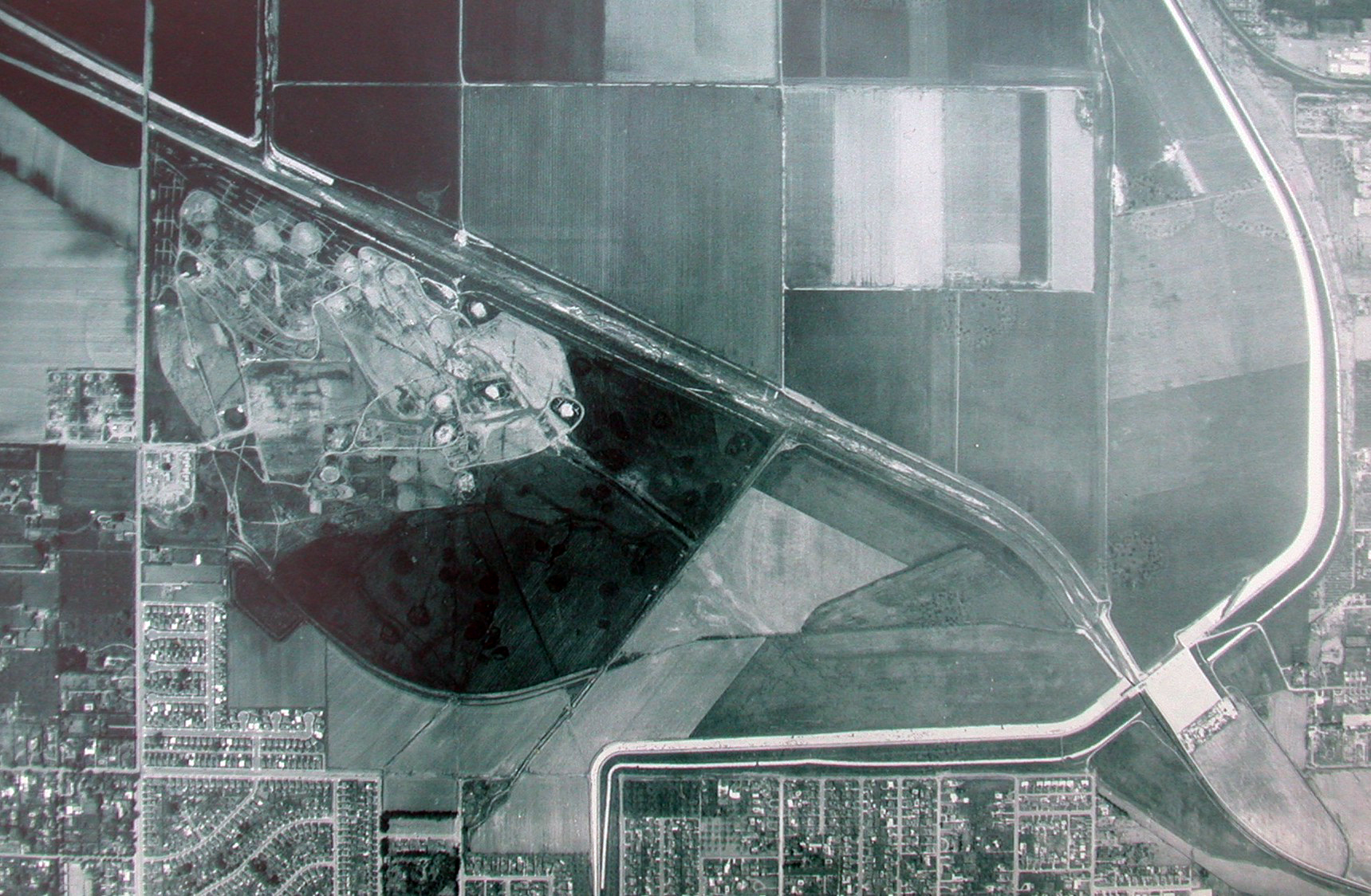
In March of 1981, a revised Master Plan for the area was adopted. At the time, of the 2,150 acres in the Sepulveda Basin, approximately 1,060 acres were committed to recreational uses. The updated Master Plan designated an additional 540 acres for future recreational uses. Included in the plan are provisions for the commitment of approximately 220 acres of land to informal park space, 120 acres for development of a recreational lake, 108 acres for a wildlife management area, and 60 acres for an “arts park” that has been subsequently redesignated for a “sports complex” (the area west of Balboa Blvd. just north of the Los Angeles River. |
||
The Master Plan also tried to minimize adverse environmental effects and recommended “designing reaches of newly-formed lakes and ponds |
||
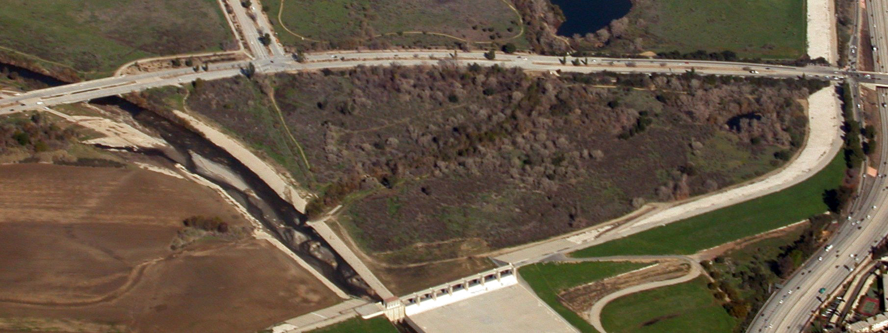
In 1979 the Corp of Engineers developed the first area of the Wildlife Reserve (formerly called the South Reserve), an approximate 48 acre parcel located south of Burbank Blvd and bordered by the Los Angeles River and the Sepulveda Dam on the east and south. A “pothole” pond (fed with piped-in fresh water) was created, and vegetation representing coastal sage scrub and riparian woodlands were planted.
This area was drastically altered in December 2012 and as of January
2013 there were ongoing negotiations between environmental groups and
the Army Corps of Engineers (see section above below upcoming events). |
||
The approximate 60-acre North Reserve (north of Burbank Blvd., east of Haskell Creek, west of the Dam) was developed in 1988, featuring an 11-acre lake with an island and wildlife viewing stations. Various revegetation projects have been undertaken since then. |
||
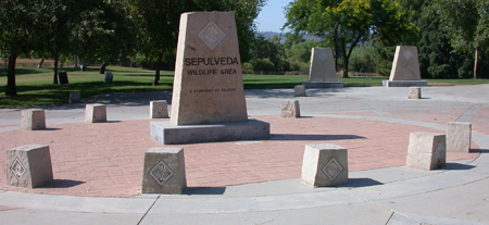 |
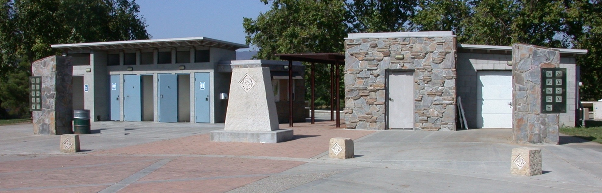 |
|||
the reserve entrance and restrooms. |
||||
In 1991 the Tillman Water Reclamation Plant Flood Protection Project was finalized, and subsequently a berm was built around the Water Reclamation Plant to protect it from flooding, compensating excavation was performed in various places, and the outflow from the Water Reclamation Plant was rerouted under the dam so the outflow was outside (to the south) of the Dam. The 7-acre berm was planted with California native plants and is the largest native landscaping project developed by the City of Los Angeles. |
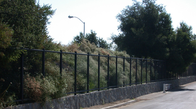 |
|||
In 1994, the City and Federal governments agreed to sharing the costs on $11 million in improvements in the Sepulveda Basin. The wildlife are was expanded 110 acres to the west of Haskell Creek (on either side of Woodley Avenue). Additional facilities in the wildlife area included trails, restrooms and staging area, signs, benches, viewing blinds and parking. This project was completed in 1999. |
||
|
Member Organizations and Affiliated Agencies |
 SFV Audubon |
 California Native Plant Society |
 L.A. Audubon |
 Sierra Club, San Fernando Valley Group |
 |
 FoLAR |
 LA City Rec and Parks |
 Resource Conservation District |
 The Japanese Garden |
 |
|
|
||
 |
||
Web page and design by Justin Baker. |
||
|
Last Updated 10/20/2026 |
||
 |
||